Abstract
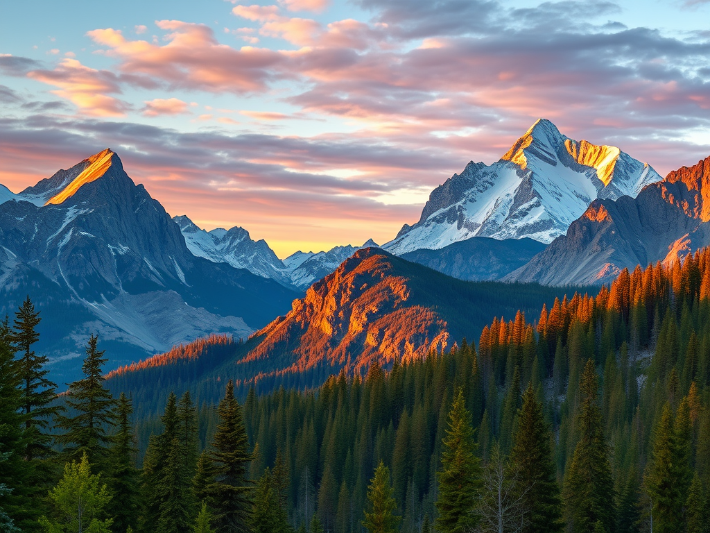
From the billion-year-old roots of the Appalachians to the actively rising Alaska Range, U.S. mountains embody an extraordinary span of geologic time, relief, climate influence, and human value. This paper synthesizes current federal datasets and recent scholarship to compare the nation’s principal ranges, assess their environmental “services,” and quantify their economic footprint—while adding maps, reflection questions, a glossary, and calls to action.
1. Geological Framework
| Range | Peak Orogeny (Ma = million yr) | Highest Summit & Elev. |
|---|---|---|
| Appalachian Highlands | continental collisions ~500-300 Ma; crystalline cores >1 Ga (National Park Service) | Mount Mitchell 6,684 ft / 2,037 m (National Park Service) |
| Rocky Mountains | Laramide uplift 80-55 Ma | Mount Elbert 14,439 ft / 4,401 m (US Geological Survey) |
| Sierra Nevada | batholith crystallised ~100 Ma; rapid uplift <5 Ma | Mount Whitney 14,494 ft / 4,418 m (National Park Service) |
| Cascade Range | arc volcanism since ~7 Ma | Mount Rainier 14,411 ft / 4,392 m (NPS data) |
| Alaska Range | subduction-driven, ongoing since ~60 Ma | Denali 20,310 ft / 6,190 m (National Park Service) |
Section 1 – Summary
- Ancient Appalachians show advanced erosion and dense forest cover, whereas western and Alaskan ranges are tectonically youthful, high-relief, and seismically/volcanically active.
- Elevation differences set the stage for contrasting climates, hydrology, and economies.
2. Environmental Functions
2.1 Snow-pack “Water Towers”
High peaks store winter snow and glacial ice that meter runoff to the Colorado, Columbia, Sacramento–San Joaquin and Yukon basins, buffering 70+ million downstream users. The 2025 USGS Integrated Water Availability Assessment warns that warming is shortening snow seasons and accelerating melt(USGS Publications Warehouse).
2.2 Climate & Weather Modulation
Orographic uplift wrings Pacific moisture onto the windward Cascades/Sierra (annual precipitation >140 in), while lee-side rain-shadows foster the Columbia Plateau and Great Basin deserts. Snow albedo from the Rockies influences regional jet-stream positioning, altering storm tracks(USGS Publications Warehouse).
2.3 Biodiversity Hotspots
Steep elevational gradients pack multiple biomes into narrow zones; Great Smoky Mountains NP alone harbors >19,000 documented species and is considered one of the world’s richest temperate-zone refugia(National Park Service).
Section 2 – Summary
- Mountains act as water, climate, and biodiversity engines whose services underpin valley agriculture, hydropower, and cultural identity.
- Rapid climate change threatens these services via snow loss, treeline shifts, and increased disturbance (fire, debris-flow).
3. Socio-Economic Dimensions
3.1 Outdoor Recreation & Tourism
In 2023 Colorado’s recreation economy—dominated by mountain sports—generated $17.2 billion and 132,500 jobs, representing 3.2 % of state GDP(Axios). Nationally, mountain gateway communities around parks such as Denali, Yosemite, and Great Smoky Mountains capture a significant share of the Outdoor Industry’s $1.2 trillion contribution to U.S. GDP.
3.2 Extractive & Renewable Resources
The Rockies supply molybdenum, copper, helium, and unconventional hydrocarbons, while their windy passes and steep headwaters are prime sites for utility-scale wind and pumped-hydro energy storage (USGS energy assessments).
3.3 Ecosystem-Service Accounting
Forested slopes filter drinking water, sequester carbon, and stabilize soils—benefits often undervalued in markets yet critical for downstream cities. Emerging payment-for-ecosystem-services schemes aim to monetize this natural infrastructure.
Section 3 – Summary
- Mountains drive robust recreation economies and supply critical raw materials, yet over-reliance on extraction can saddle localities with long-term remediation costs.
- Diversification toward sustainable tourism and renewable energy offers resilience.
4. Key Terms (Glossary)
| Term | Definition |
|---|---|
| Orogeny | A mountain-building episode caused by tectonic plate interactions. |
| Orographic Lift | Upward air movement over terrain that triggers cooling and precipitation. |
| Albedo | The fraction of solar radiation reflected by a surface; snow has high albedo. |
| Biodiversity Hotspot | Region with exceptional species richness and endemism under threat. |
| Ecosystem Service | A benefit humans derive from ecosystems (e.g., clean water, carbon storage). |
5. Reflect & Discuss
- Water Security: How might diminished snowpack alter interstate water-sharing agreements in the Colorado River Basin?
- Energy Transition: Should high-elevation wind projects be prioritized over fossil fuel extraction in mountain counties?
- Equity & Access: What policies could widen access to mountain recreation without degrading trail networks?
(Use these prompts in classroom or comment threads to deepen engagement.)
6. Call to Action
Get outside—responsibly. Explore a local mountain trail or scenic byway, purchase a park pass that funds conservation, or volunteer for a trail-maintenance crew. Small actions by many visitors help preserve the very landscapes that fuel America’s recreation economy and ecological health.
Works Cited (selected)
USGS 2025 Climate Change and Future Water Availability in the United States(USGS Publications Warehouse) · NPS Mount Mitchell page(National Park Service) · USGS Mt Elbert media image(US Geological Survey) · NPS Mt Whitney guide(National Park Service) · NPS Denali geodiversity page(National Park Service) · NPS plate-tectonics article (Appalachian age)(National Park Service) · GISGeography “10 U.S. Mountain Ranges Map”(GIS Geography) · Axios report on Colorado recreation economy(Axios) · NPS Great Smoky Mountains biodiversity overview(National Park Service)
Section Recap: You’ve now seen how geology sets the stage, ecology delivers life-support systems, and economies rise on mountain shoulders. Keep these connections in mind the next time a ridgeline comes into view—and consider what role you can play in its future.


Leave a comment